2. Wild Clay Research A
Wild Clay Research B↗
3. Process↗
4. Artwork↗
5. Interview↗
전시 전경↗
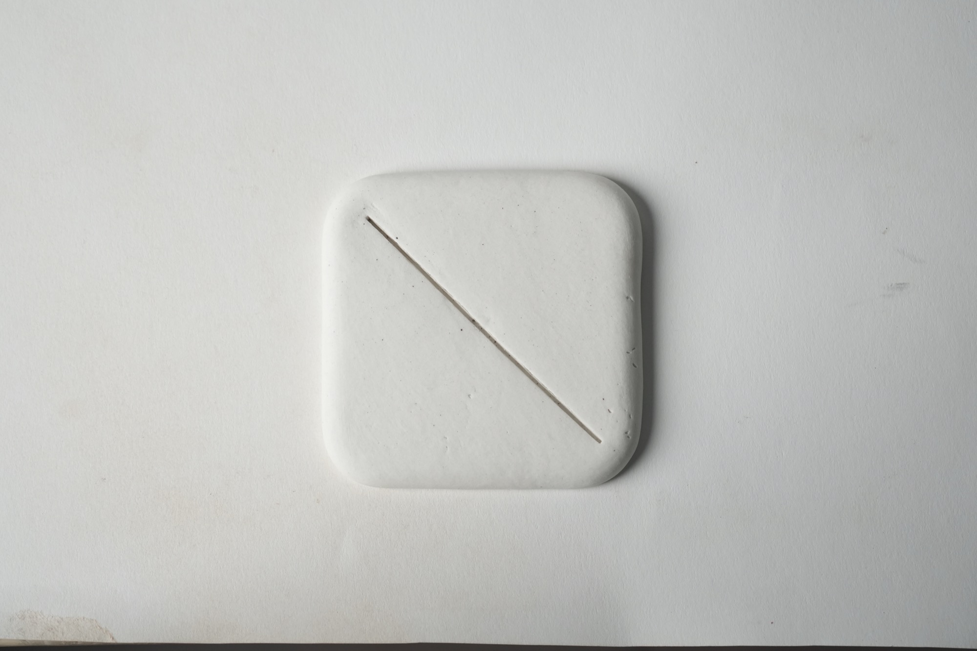
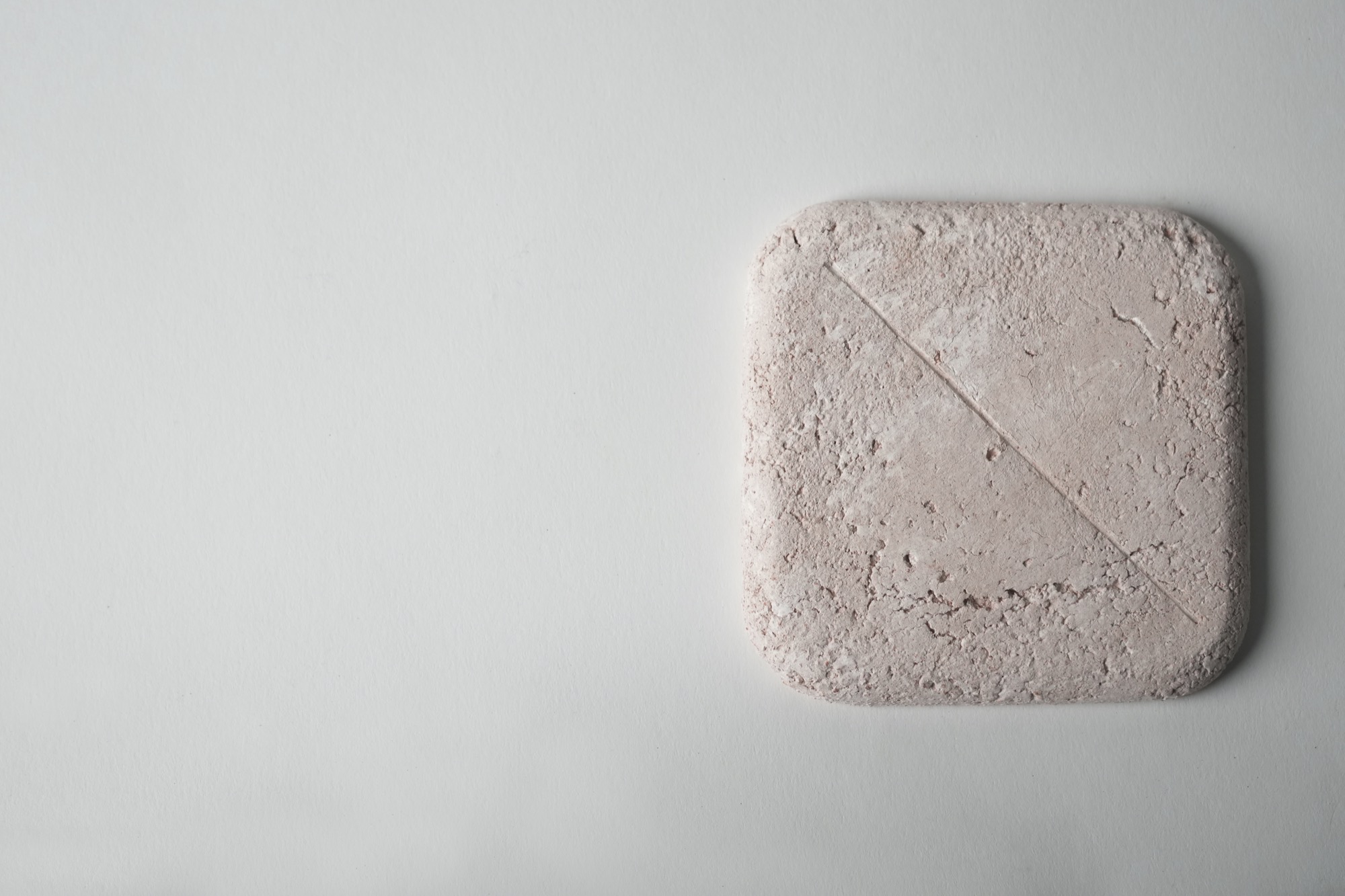
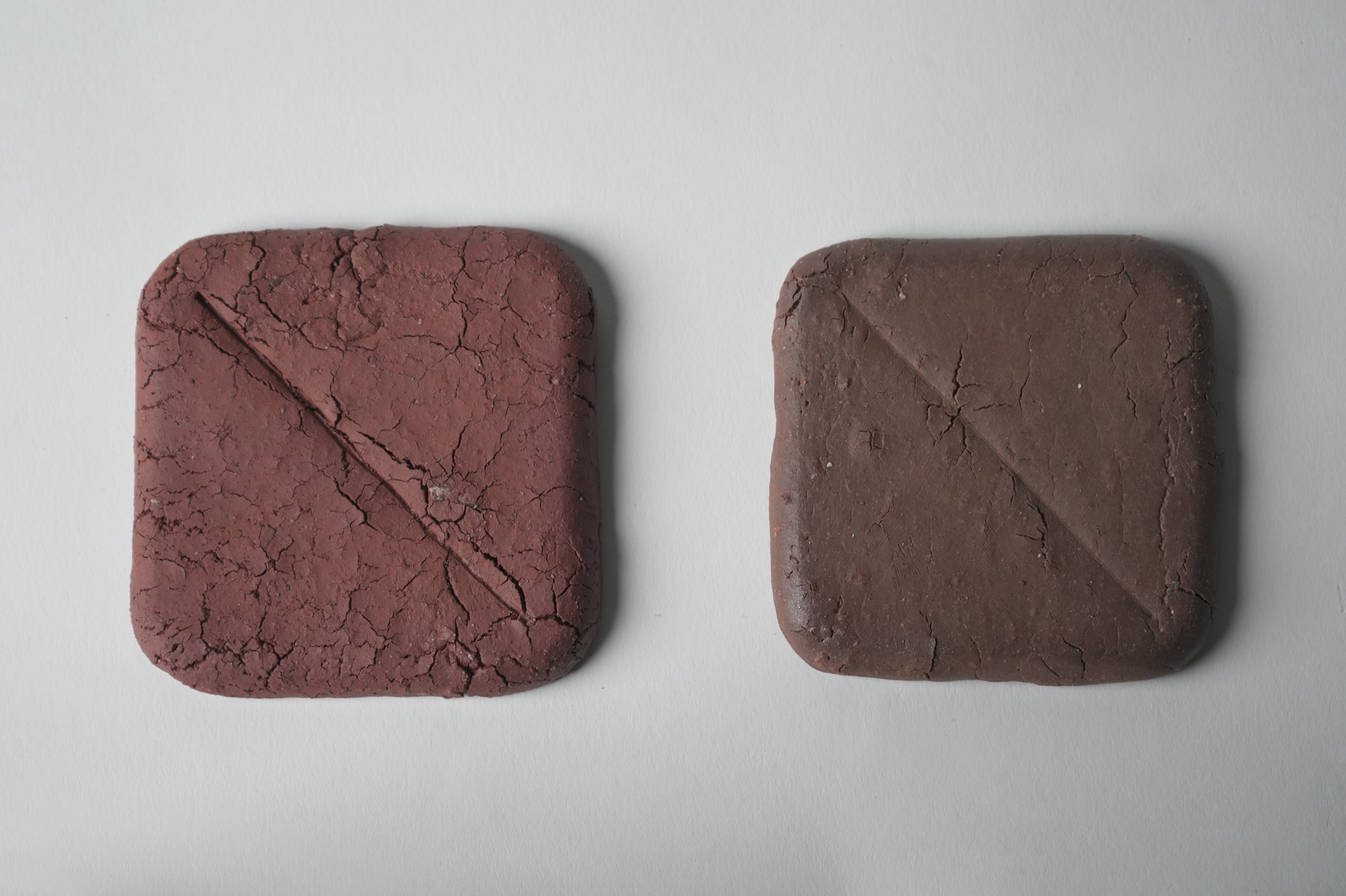
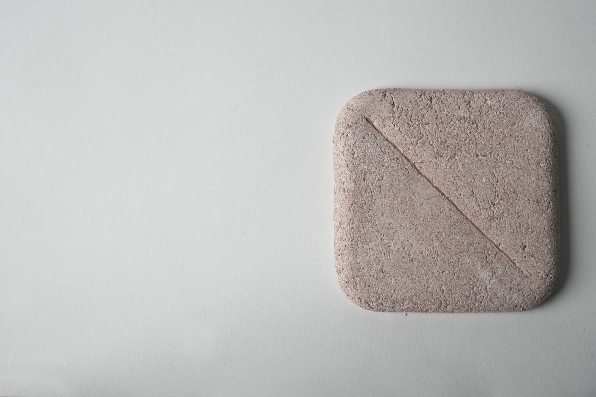
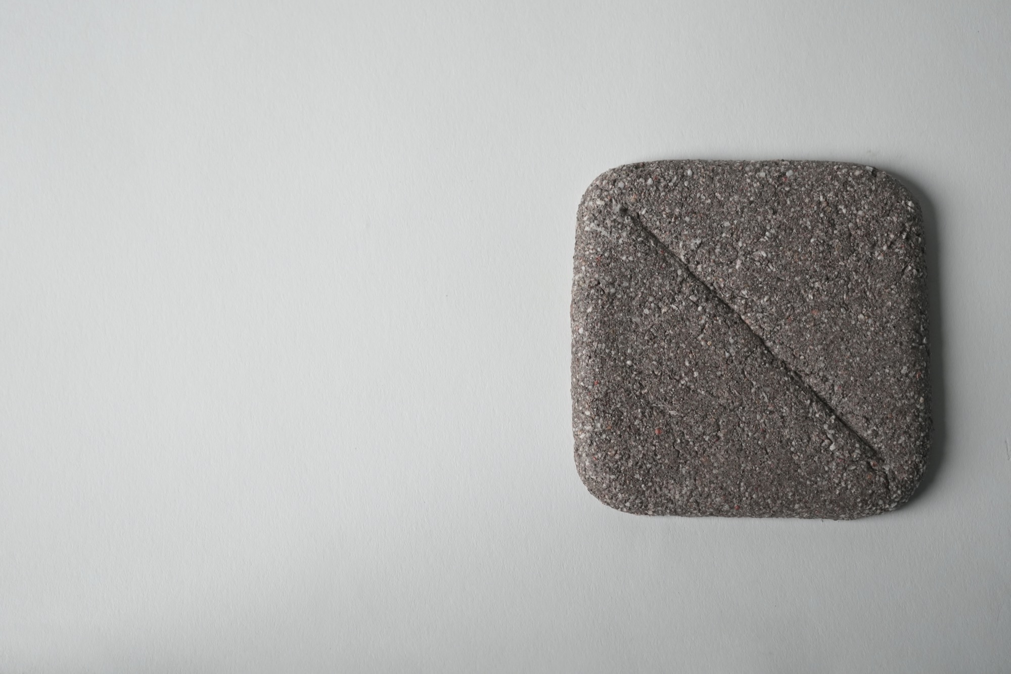
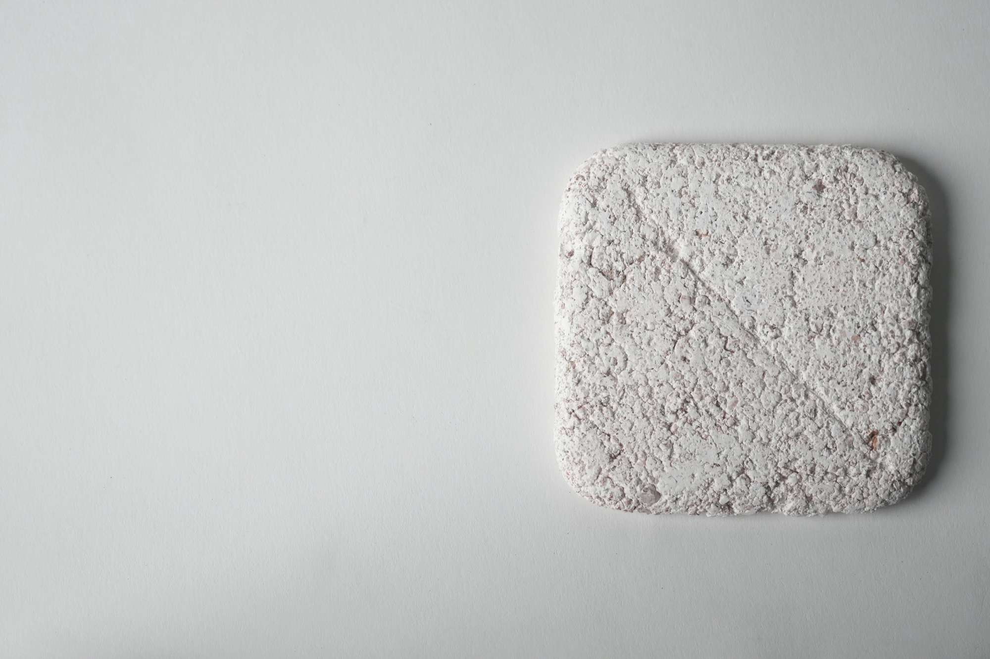
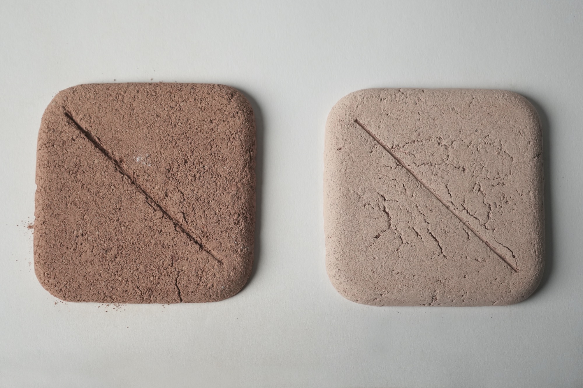
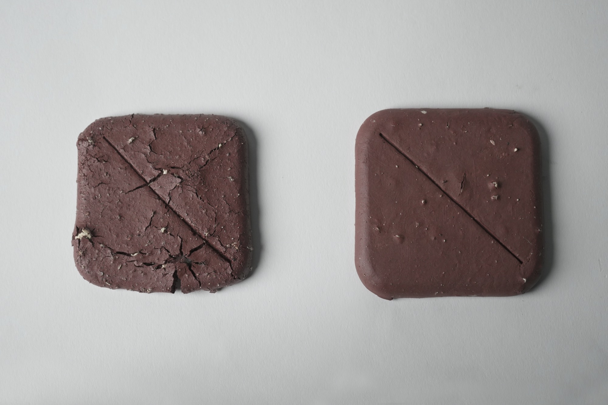
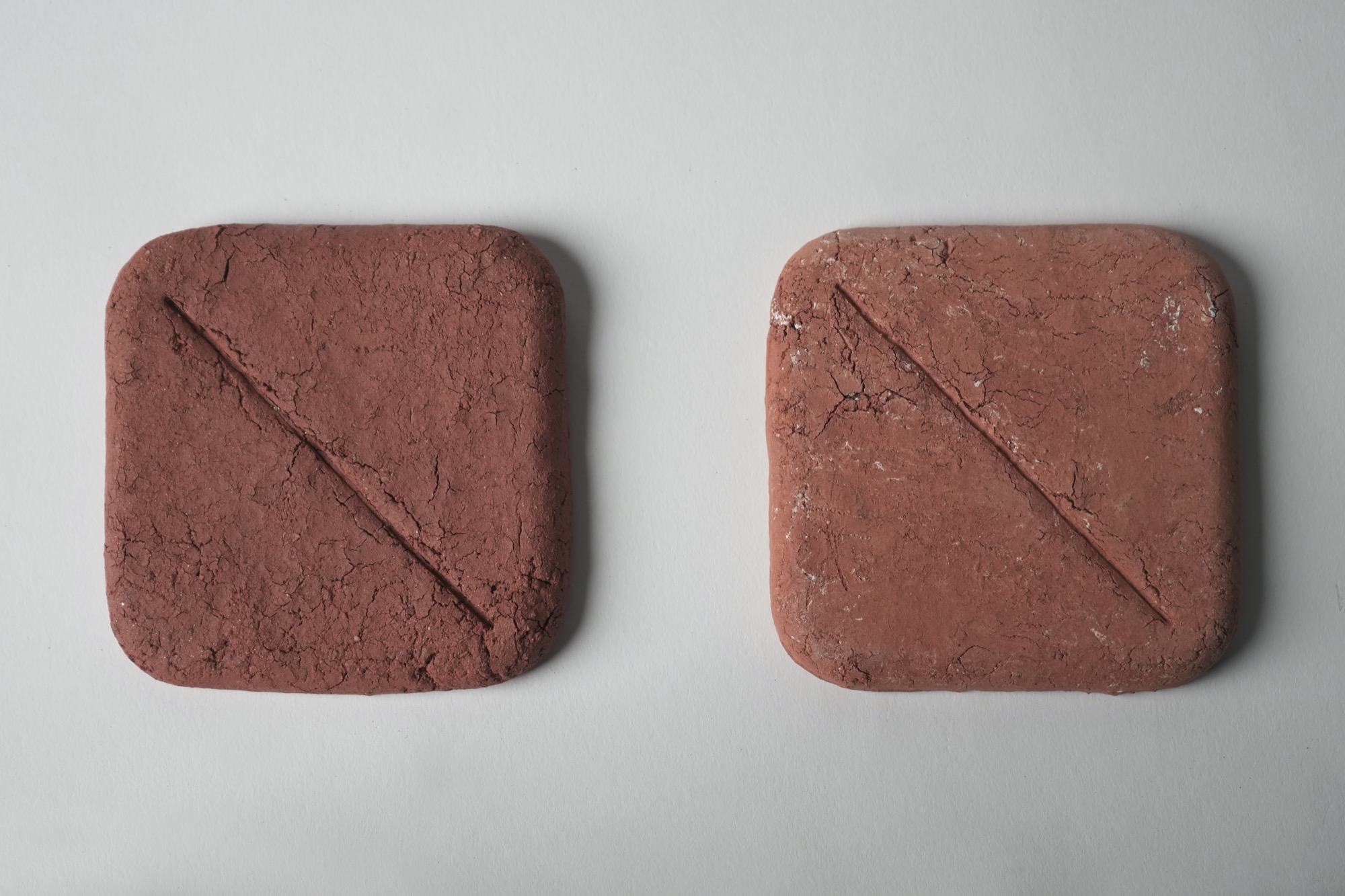
Wild Clay: Fired native soil collected from nature. Test failed in case of sandy loin soil.
Mixed Clay: Mixing ROS white clay and wild clay in a 4:6 ratio.
ROS White Clay
인도네시아 카올린:네플린사이나이트:부여규석 = 1:1:1
Indonesian Kaolin:Nepheline Syenite:Buyeo Silica=1:1:1
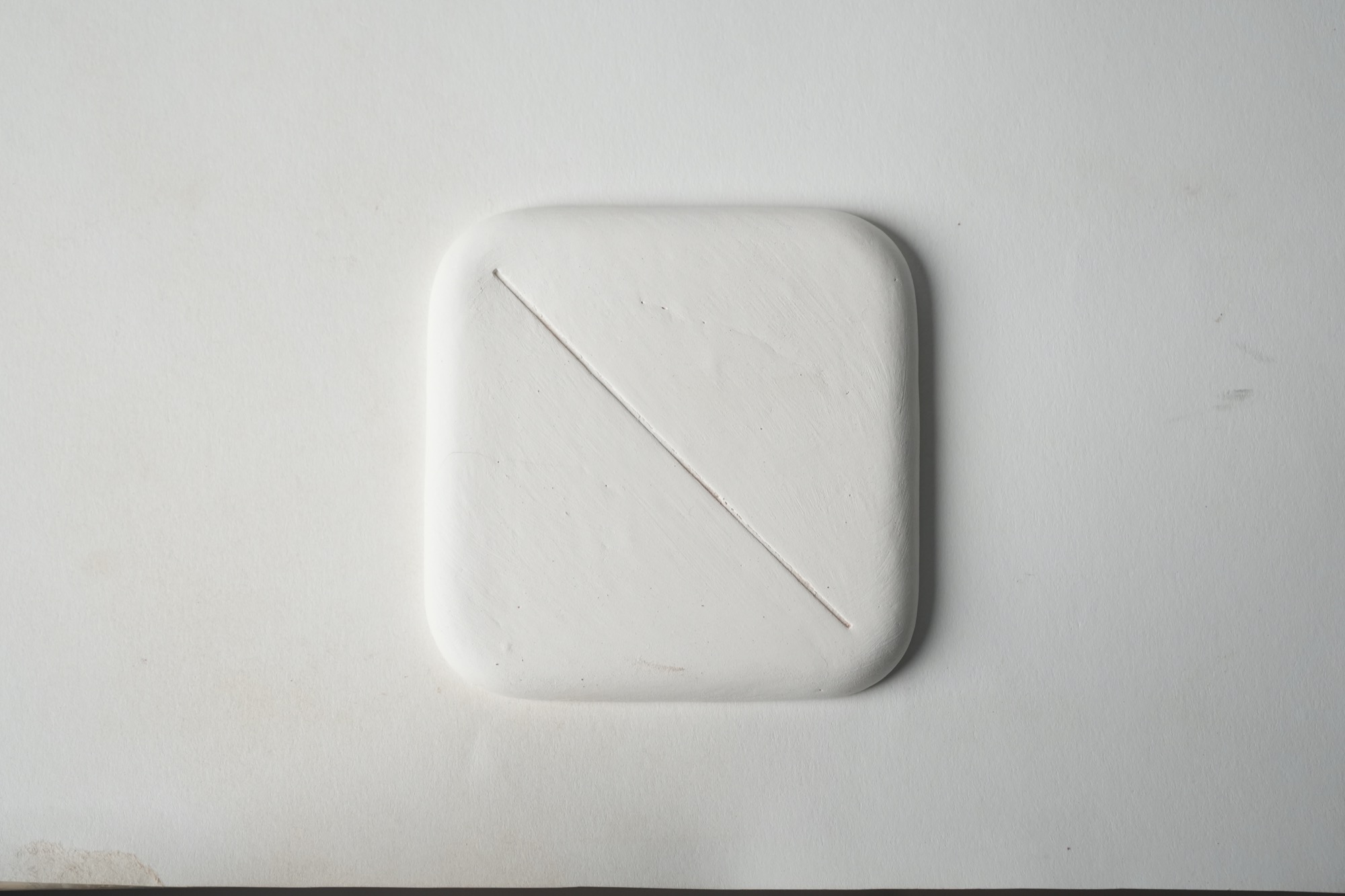
cone 014

cone 01
cone 8
가평 Gapyeong
site: 경기도 가평군 상면 행현리 Haenghyeon-ri, Sang-myeon, Gapyeong-gun, Gyeonggi-do, Republic of Korea
latitude longitude: 37.77818 127.35659
GPS: 38° 47' 41" N / 127° 21' 24" E
topography: 산지 mountain
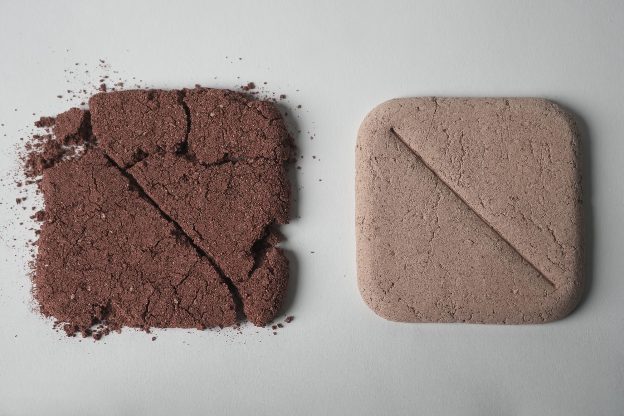
clay research: wild clay(left), mixed clay(right)

cone 014
cone 01

cone 8
광주 Gwangju
site: 경기도 광주시 남한산성면 불당리 Buldang-ri, Namhansanseong-myeon, Gwangju-si, Gyeonggi-do, Republic of Korea
latitude longitude: 37.45792 127.21488
GPS: 37° 27' 29" N / 127° 13' 54" E
topography: 평지 flatland
clay research: wild clay(left), mixed clay(right)

cone 014

cone 01

cone 8
경주 Gyeongju
site: 경상북도 경주시 외동읍 문산리 Munsan-ti, Oedong-eup, Gyeongju-si, Gyeongsangbuk-do, Republic of Korea
latitude longitude: 35.68420 129.31718
GPS: 36° 41' 3" N / 129° 19' 2" E
topography: 산지 mountain
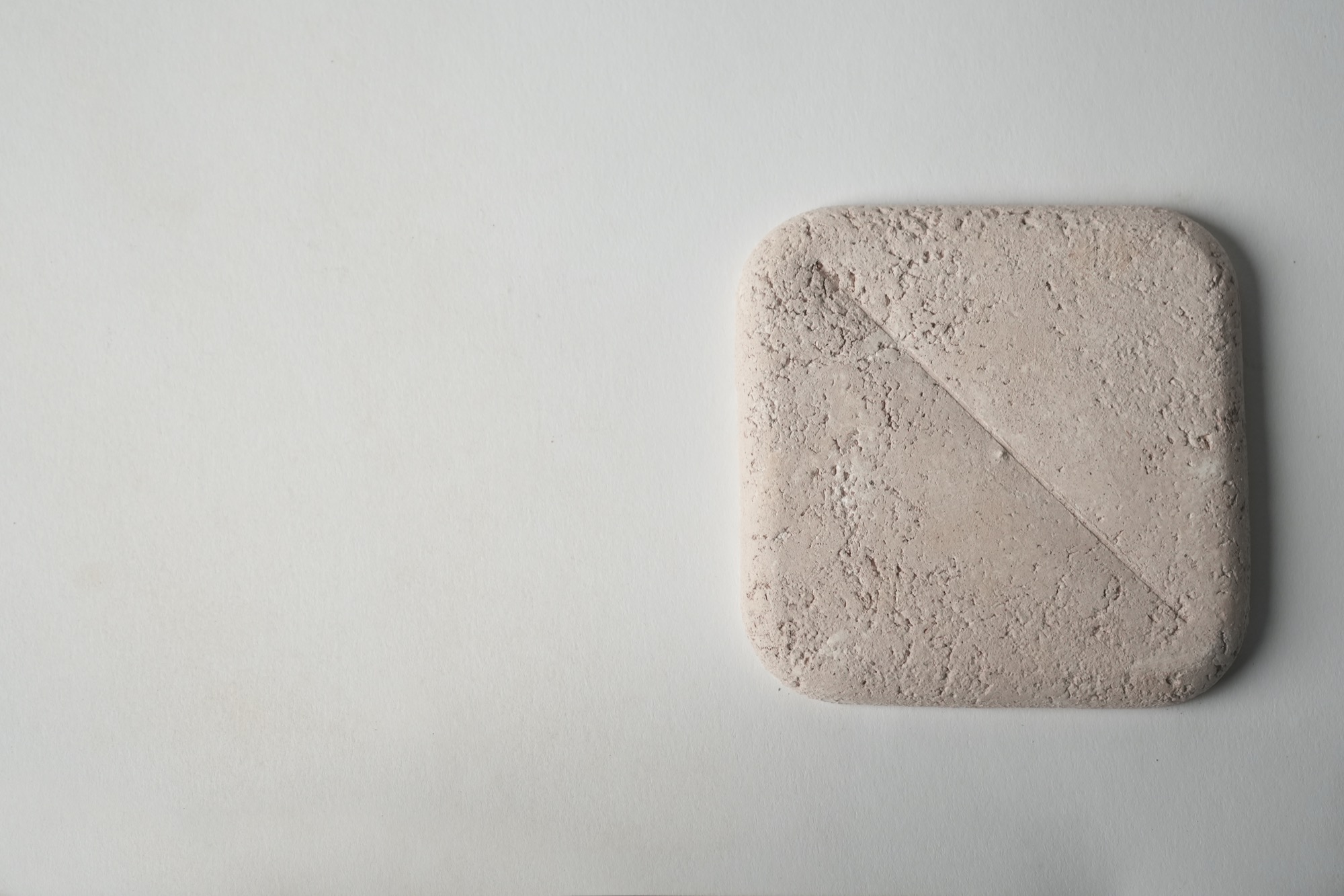
clay research: wild clay(X), mixed clay(right)
cone 014
cone 01

cone 8
남양주 Namyangju
site: 경기도 남양주시 와부읍 팔당리 Paldang-ri, Wabu-eup, Namyangju-si, Gyeonggi-do, Republic of Korea
latitude longitude: 37.54904 127.24615
GPS: 38° 33' 57" N / 127° 15' 46" E
topography: 산지 mountain
clay research: wild clay(left), mixed clay(right)

cone 014

cone 01
cone 8
안동 Andong
site: 경상북도 안동시 와룡면 중가구리 Junggui-ri, Waryong-myeon, Andong-si, Gyeongsangbuk- do, Republic of Korea
latitude longitude: 36.59388 128.77590
GPS: 7° 36' 38" N / 129° 47' 33" E
topography: 평지 flatland
clay research: wild clay(x), mixed clay(right)

cone 014
cone 01
cone 8
양주 Yangju
site: 경기도 양주시 은현면 용암리 Yongam-ri, Eunhyeon-myeon, Yangju-si, Gyeonggi-do, Republic of Korea
latitude longitude: 37.84093 127.03031
GPS: 38° 50' 27" N / 127° 2' 49" E
topography: 계곡 valley
clay research: wild clay(x), mixed clay(right)

cone 014
cone 01

cone 8
영월 Yeongwol
site: 강원도 영월군 영월읍 영흥리 Yeongheung-ri, Yeongwol-eup, Yeongwol-gun, Gangwon-do, Republic of Korea
latitude longitude: 37.24788 128.46055
GPS: 37° 15' 52" N / 128° 28' 38" E
topography: 산지 mountain
clay research: wild clay(left), mixed clay(right)

cone 014

cone 01

cone 8
이천 Icheon
site: 경기도 이천시 백사면 도립리 Dorip-ri, Baeksa-myeon, Icheon-si, Gyeonggi-do, Republic of Korea
latitude longitude: 37.34093 127.46214
GPS: 37° 20' 27" N / 127° 28' 44" E
topography: 언덕 hill
clay research: wild clay(left), mixed clay(right)

cone 014

cone 01

cone 8
의성 Uiseong
site: 경상북도 의성군 안사면 안사리 Ansa-ri, Ansa-myeon, Uiseong-gun, Gyeongsangbuk-do, Republic of Korea
latitude longitude: 36.43287 128.47506
GPS: 36° 26' 58" N / 128° 29' 30" E
topography: 평지 flatland
clay research: wild clay(left), mixed clay(right)
cone 014

cone 01

cone 8
정선 Jeongseon
site: 강원도 정선군 남면 낙동리 Nakdong-ri, Nam-myeon, Jeongseon-gun, Gangwon-do, Republic of Korea
latitude longitude: 37.31753 127.71868
GPS: 37° 19' 3" N / 129° 43' 7" E
topography: 언덕 hill
clay research: wild clay(left), mixed clay(right)

cone 014

cone 01
cone 8
파주 Paju
site: 경기도 파주시 조리읍 장곡리 Janggok-ri, Jori-eup, Paju-si, Gyeonggi-do, Republic of Korea
latitude longitude: 37.75837 126.83344
GPS: 38° 46' 30" N / 127° 50' 0" E
topography: 산지 mountain
clay research: wild clay(left), mixed clay(right)

cone 014
cone 01

cone 8
평창 Pyeongchang
site: 강원도 평창군 미탄면 회동리 Hoedong-ri, Mitan-myeon, Pyeongchang-gun, Gangwon-do, Republic of Korea
latitude longitude: 37.37003 128.48815
GPS: 37° 22' 12" N / 128° 29' 17" E
topography: 산지 mountain
clay research: wild clay(left), mixed clay(right)

cone 014

cone 01

cone 8